VectorImport
This tool importgs GIS vector data for rivers, in particular Polyline data into the m_adWater array in the geography group of a QDF file.
Code: VectorImport.cpp
Usage
$QHG4_DIR}/import/VectorImport -s <surf_file>  -q <qdf_file>
                               -v <shp_file> -d <dbf_file> -f <field_name>[:<match_val>[:<use_val>]]
                              [-o <output_qdf>]
where
surf_filea surface description file (.ico, .ieq, …). Can be omitted if the grid of qdf_gile is an EQsahedron.
qdf_fileqdf file corresponding to <surf_file>.
shp_fileSHP file containig vector data.
dbf_fileDBF file corresponding to <shp_file>.
field_namename of field in <dbf_file> to extract. To see all possible field names, call with ‘-d <dbf_file> only.
matchvaltarget value to select indexes.
usevalvalue to use instead of matchval.
output_qdfname of output qdf to create. If omitted and input_qdf is given, input_qdf will be modified
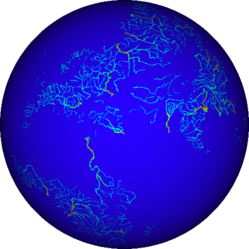
<surf_file>and<ign_file>are needed to create a cell grid with Geography.all points contained in the poly lines are extracted and the values for <field_name> are used as entries in the QDF files “Water” array corresponding to the points’ coordinates
If <match_val> is specified, only polylines whose <field_name> value equals <match_val> are used, and the array is set to <use_val> (or 1.0) in the corresponding places
Examples
List the field names:
./VectorImport -d ~/rivers/ne_10m_rivers.dbf
Convert (using CellGrid and Geo from qdf file):
./VectorImport -q GridSG_ieq_256.qdf -v ~/rivers/ne_10m_rivers.shp -d ~/rivers/ne_10m_rivers.dbf -f strokeweig -o rivers_1a_256.qdf